Home
History:
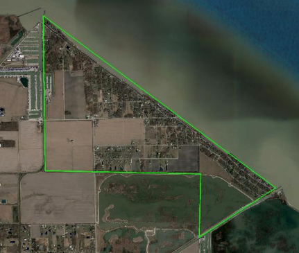
The Reno Beach/Howard Farms Conservancy District (the “District”) is located in northeastern Jerusalem Township, Lucas County, Ohio, and encompasses approximately 1,200 acres over 2,287 individual parcels along the Lake Erie shoreline. The District generally extends between Cooley Canal to the west, the Wards canal on the east, and the Howard Marsh Metropark to the south as shown in the figure below.
Following the record flood of 1913, the greatest natural disaster in Ohio’s recorded history, the Ohio General Assembly passed the Ohio Conservancy Law (Ohio Revised Code Section 6101 ~ https://codes.ohio.gov/ohio-revised-code/chapter-6101). ORC6101 enables the formal establishment of Conservancy Districts that are intended to provide protective works to minimize the effects of potential flooding.
Due to flooding that occurred along Lake Erie in May 1943, two (2) smaller districts were originally formed as the Howard Farms Conservancy District (est. 1944) and the Lake Erie Conservancy District No. 1. The two (2) smaller districts were combined into the single entity of the Reno Beach Howard Farms Conservancy District by an order of the Lucas County Court of Common Pleas in 1994.
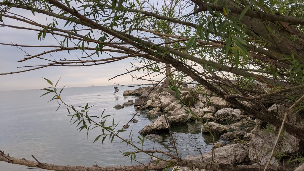
The original flood control works were constructed by local private property owners beginning in 1902 and extending to 1943. Governmental assistance was provided in 1973 when the US Army Corps of Engineers (USACE) launched a large-scale effort to protect against flooding along the shoreline. USACE completed a permanent protective dike (AKA – “the project segment”) extending from the Cooley Canal to Wards Canal to and southwesterly along the Wards Canal for a total of 7,520 feet of levee completed in 1993. This levee requires annual inspections and regular maintenance, including tree and brush removals. The remaining portions of the levee system surrounding the District, extending westerly to and then northerly and parallel with the Cooley Canal, were constructed privately beginning in about 1902 through 1943. Additionally, the Toledo Metroparks constructed a dike and levee system surrounding what is now the Howard Marsh. The north levee of the Howard Marsh replaced the private dikes east of Howard Road to the Wards Canal.
Based upon information available through the Federal Emergency Management Agency (FEMA), US Army Corps of Engineers (USACE), and National Oceanic & Atmospheric Administration (NOAA), the top of the existing levee system surrounding the District varies from a low point elevation of 575.8 to a high point of 582.8 and the existing lands behind the levee system range from 568.0 to 574.0. FEMA indicates that the 1% annual chance exceedance (ACE), or 100-year flood elevation, for this area is 578.0. It is currently estimated that damages exceeding $100MM and potential loss of life could occur if a 1% (100-year), or greater, flood were to occur in this area.
What We Do:
The Reno Beach Howard Farms Conservancy District (the “District”) was organized to develop and implement a plan to reduce the risks of flooding within the areas surrounded by the existing levee system. The risk of flooding is reduced through the maintenance of levees and stormwater pumping stations.
The lakeshore levee, or “Project Segment”, extending from the Cooley Canal to and along Wards Canal was completed in 1993 and updated the original emergency levee constructed by the US Army Corp of Engineers in 1972. The modifications to create the existing levee along the lakeshore were completed to protect the area from waves and tidal surges from Lake Erie. The remaining levees and dikes were constructed privately beginning in 1902 through about 1943.
Three (3) electrically operated stormwater pumping stations are located strategically along drainage lagoons/canals within the District. The Coolie Station is located at the westerly end of Lakeway Drive. The East Station is located just north of the intersection of Corduroy and East Roads. The LaPoint Road Station is located within the Howard Marsh Metropark, on the northerly levee and just west of Wards Canal.
A fourth, emergency standby station that is operated by a tractor’s power takeoff (PTO) drive is located southwesterly of the intersection of Toulon and Marais and on top of the Howard Marsh levee. During periods of rainfall, snowmelt, and/or seepage through the levee system, water is collected through open ditches and channels and directed to the lagoons/canals that feed the pumping stations. The stations are currently started and stopped manually by the District.
In addition to operating and maintaining the levee and pumping systems, the District works collaboratively with Township, County, State and Federal Agencies to create, refine and implement an Emergency Action Plan (EAP).